Showing posts with label glaciers. Show all posts

Sunday, July 12, 2015

When the End of Human Civilization Is Your Day Job

In the photo: Glaciologist Jason Box, left, at work on the Petermann Glacier on Greenland’s northwest coast, which has lost mass at an accelerated pace in recent years. Box and his family left Ohio State for Europe a couple years ago, and he is relieved to have escaped America’s culture of climate-change denial.

Jason Box

The incident was small, but Jason Box doesn’t want to talk about it. He’s been skittish about the media since it happened. This was last summer, as he was reading the cheery blog posts transmitted by the chief scientist on the Swedish icebreaker Oden, which was exploring the Arctic for an international expedition led by Stockholm University. “Our first observations of elevated methane levels, about ten times higher than in background seawater, were documented … we discovered over 100 new methane seep sites…. The weather Gods are still on our side as we steam through a now ice-free Laptev Sea….”

As a leading climatologist who spent many years studying the Arctic at the Byrd Polar and Climate Research Center at Ohio State, Box knew that this breezy scientific detachment described one of the nightmare long-shot climate scenarios: a feedback loop where warming seas release methane that causes warming that releases more methane that causes more warming, on and on until the planet is incompatible with human life. And he knew there were similar methane releases occurring in the area. On impulse, he sent out a tweet.

“If even a small fraction of Arctic sea floor carbon is released to the atmosphere, we’re f’d.”

The tweet immediately went viral, inspiring a series of headlines:

CLIMATOLOGIST SAYS ARCTIC CARBON RELEASE COULD MEAN “WE’RE FUCKED.”

CLIMATE SCIENTIST DROPS THE F-BOMB AFTER STARTLING ARCTIC DISCOVERY.

CLIMATOLOGIST: METHANE PLUMES FROM THE ARCTIC MEAN WE’RE SCREWED.

Box has been outspoken for years. He’s done science projects with Greenpeace, and he participated in the 2011 mass protest at the White House organized by 350.org. In 2013, he made headlines when a magazine reported his conclusion that a seventy-foot rise in sea levels over the next few centuries was probably already “baked into the system.” Now, with one word, Box had ventured into two particularly dangerous areas. First, the dirty secret of climate science and government climate policies is that they’re all based on probabilities, which means that the effects of standard CO2 targets like an 80 percent reduction by 2050 are based on the middle of the probability curve. Box had ventured to the darker possibilities on the curve’s tail, where few scientists and zero politicians are willing to go. More


Saturday, January 10, 2015

On a tropical island, fossils reveal past -- and possible future -- of polar ice

The balmy islands of Seychelles couldn’t feel farther from Antarctica, but their fossil corals could reveal much about the fate of polar ice sheets.

About 125,000 years ago, the average global temperature was only slightly warmer, but sea levels rose high enough to submerge the locations of many of today’s coastal cities. Understanding what caused seas to rise then could shed light on how to protect those cities today.

The balmy islands of Seychelles couldn’t feel farther from Antarctica, but their fossil corals could reveal much about the fate of polar ice sheets.

About 125,000 years ago, the average global temperature was only slightly warmer, but sea levels rose high enough to submerge the locations of many of today’s coastal cities. Understanding what caused seas to rise then could shed light on how to protect those cities today.

By examining fossil corals found on the Indian Ocean islands, University of Florida geochemist Andrea Dutton found evidence that global mean sea level during that period peaked at 20 to 30 feet above current levels. Dutton’s team of international researchers concluded that rapid retreat of an unstable part of the Antarctic ice sheet was a major contributor to that sea-level rise.

“This occurred during a time when the average global temperature was only slightly warmer than at present,” Dutton said.

Dutton evaluated fossil corals in Seychelles because sea level in that region closely matches that of global mean sea level. Local patterns of sea-level change can differ from global trends because of variations in Earth’s surface and gravity fields that occur when ice sheets grow and shrink.

In an article published in the January 2015 issue of Quaternary Science Reviews, the researchers concluded that while sea-level rise in the Last Interglacial period was driven by the same processes active today — thermal expansion of seawater, melting mountain glaciers and melting polar ice sheets in Greenland and Antarctica — most was driven by polar ice sheet melt. Their study, partially funded by the National Science Foundation, also suggests the Antarctic ice sheet partially collapsed early in that period.

“Following a rapid transition to high sea levels when the last interglacial period began, sea level continued rising steadily,” Dutton said. “The collapse of Antarctic ice occurred when the polar regions were a few degrees warmer than they are now — temperatures that we are likely to reach within a matter of decades.”

Several recent studies by other researchers suggest that process may have already started.

“We could be poised for another partial collapse of the Antarctic ice sheet,” Dutton said. More

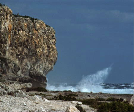
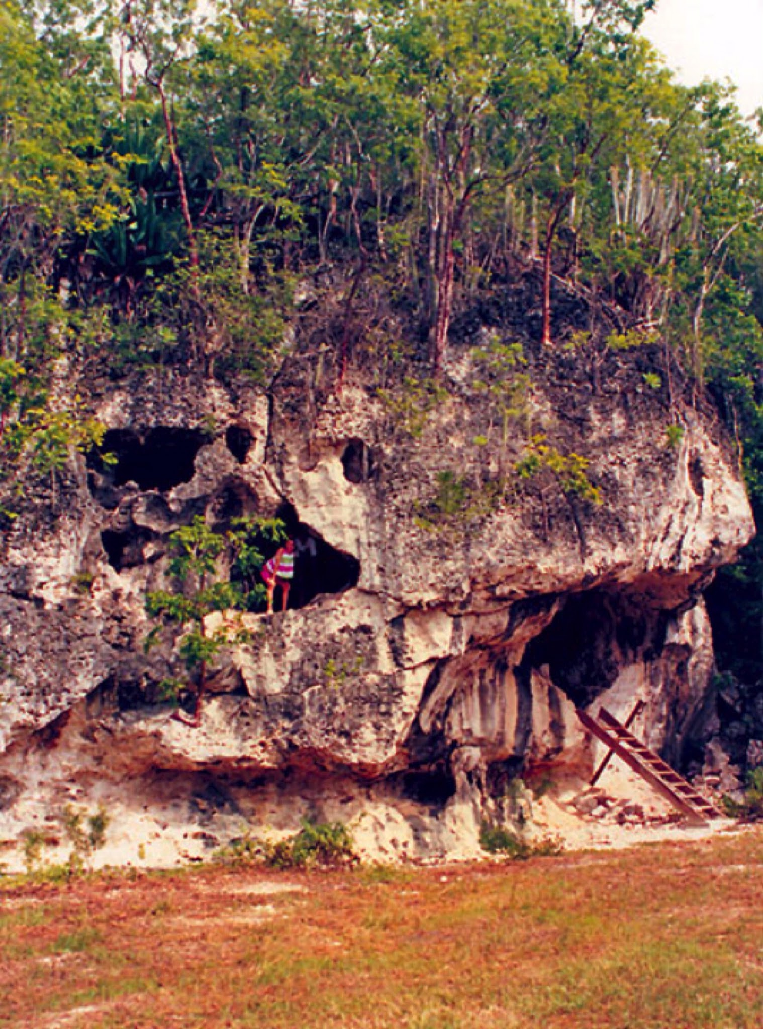
Photos above from Cayman Brac, Cayman Islands.


Tuesday, May 27, 2014

Antarctica's ice collapse threatens metres of sea level rise within decades

Scientists know that if Antarctica's ice sheets and glaciers collapse, sea levels could rise 5 metres. But the idea that it will take 200 years to happen is based on a linear model, writes Dady Cherry. In fact, the process is exponential - and could take place 'within decades'.

We conclude that this sector of West Antarctica is undergoing a marine ice sheet instability that will significantly contribute to sea level rise in decades to come.

Imagine further that a thick layer of ice covers, not only the surface of the island that lies above the sea but also an extensive portion of the perimeter that is beneath the sea.

The peaks are higher above sea level than on any continent. In winter, the sea freezes because temperatures drop to less than -80 degrees Celsius (-112 degrees Farenheight), and the island's area grows to about 10 million square miles.

In summer when some of the ice melts, the ice cover remains on average more than a mile thick, although the overall surface area of the island shrinks to about 5 million square miles. Even in summer, however, the island is still larger than Europe or Australia. It is Antarctica, and it is impossible to imagine.

When glaciers no longer rest on bedrock, they are doomed

So let us instead consider an island that is a large glacier with a thick cover of ice that extends outward, well beyond its land area. The island is shaped roughly like an infinity symbol, with the right (east) side much larger than the left (west).

The west side is really a peninsula and archipelago that share a common bedrock, but this is invisible because of the ice cover. What we can see is that even at the perimeter, where there is no land above sea level, there is ice. In some places, the ice reaches down, well beneath the water surface, all the way to the bedrock.

This situation is unstable, because in principle, the mass of ice that is beneath the sea and in continuous contact with liquid water should eventually melt. When it does, this initially leaves an overhanging shelf of ice over the water at the island's perimeter.

Being less dense than water, this shelf will want to float up and, given enough time, will eventually break away from the more interior ice that is pinned to land above sea level. Indeed, about 40% of Antarctica's perimeter consists of such ice shelves. In another 40% of the perimeter, the ice cover reaches all the way down to the bedrock.

An uncomfortable equilibrium is coming to an end

Island, ice and sea have coexisted for millennia in an uncomfortable equilibrium. In particular, the sea temperatures have not grown sufficiently warm to erode the ice edge irreversibly.

Furthermore, the mass of ice on the surface has remained relatively constant, with the seasonal flows of water out to sea in the summer being replaced by deposits of ice in winter.

The ice shelves have not thinned sufficiently to become so weak that they would snap and float away out to sea. This was all before the one-degree Celsius warming in the Earth's surface since around 1980.

Currently, the warmer seawater is eroding the island's submerged perimeter of ice. Simultaneously, the warmer air is also melting the ice cover at such an accelerated rate that it cannot be entirely replaced in the winters.

The process is irreversible

Once both kinds of erosion become irreversible, meaning that no net ice is replaced, the ice mass will shrink and become more and more bare, in a process that will accelerate out of control until the ice appears suddenly to vanish.

This is more or less the story that Eric Rignot and his colleagues reported about West Antarctica in a Geophysical Research Letters article that was accepted for publication on May 12, 2014.

They used satellite-based radar interferometry to map the edges of a series of glaciers that drain into a large bay called the Amundsen Sea Embayment, and combined their data with the results of other kinds of surveys.

Beating a rapid retreat

They discovered that between 1992 and 2011:

  • Thwaites Glacier retreated 8.7 miles (14 km) at its core and zero to six miles (1 to 9 km) at its edges,
  • Haynes Glacier retreated 6 miles (10 km) at its edges,
  • Smith / Kohler Glacier retreated about 22 miles (35 km), and its ice shelf is barely pinned to the surface.
  • Pine Island Glacier retreated 19 miles (31 km) at its center and snapped and detached from the ground.
All these retreats occurred mostly between 2005 to 2009. The authors note that they must have had a common cause and that the most reasonable explanation is the general warming of the ocean. They further explain that there is no natural land mass to prevent the movement of the massive glaciers out to sea. They conclude:

"The retreat is proceeding along fast-flowing, accelerating sectors that are thinning, become bound to reach floatation and un-ground from the bed.

"We find no major bed obstacle upstream of the 2011 grounding lines that would prevent further retreat of the grounding lines farther south.

"We conclude that this sector of West Antarctica is undergoing a marine ice sheet instability that will significantly contribute to sea level rise in decades to come."

In other words, the disappearance of West Antarctic ice is well under way, and it is irreversible.

The melting is exponential, not linear

It is notable that this research was done under difficult circumstances. For example, the authors write that, since 2001, the ERS-2 satellite has operated without its gyroscopes, and "This made it difficult to control the antenna pointing ... ".

They further observe that "In July 2011, ERS-2 terminated its mission after 16 years of services, far exceeding its planned operational lifespan."

In addition, they make a point of acknowledging "two anonymous reviewers for their comments." Possibly, the report was delayed, and some of its more frightening arguments had to be removed before publication.

In a later publication for the general public, Rignot stressed that the estimate of 200 years for the Radmunsen sea collapse, which has been repeated again and again in the press, is based on the melting continuing at its current rate.

This we know to be impossible because the melting is an exponential process that has been accelerating all the time and will continue to accelerate even more.

How long before sea rise is catastrophic?

The acceleration is driven, among other things, by an accelerated warming of the atmosphere and sea surface, continued expansion of the ozone hole, strengthening of currents that bring greater masses of warm waters from the tropics to Antarctica, weakening of the ice shelves due to accelerated melting of the surface ice, weakening of the attachment of the ice below sea level due to an accelerated erosion, and decreasing reflectivity of the Earth.

With regard to climate change, again and again, exponential processes have been treated as if they would develop linearly, despite scientists knowing quite well that they would not. Consider for example, a storm that is approaching your house from six miles away.

The storm is currently moving at five miles per hour, but it is expected to double its speed with every new mile. Do you make sure to have cover within one hour and 12 minutes, or within about 22 minutes?

Again and again, scientists have done the equivalent of feigning surprise when their timelines, based on a completely bogus linearity, have turned out to be too long. Things have gone much too far for us to continue to play such numbers' games.

West Antarctic ice sheet could raise sea levels 5m 'within decades'

Rignot blames carbon emissions, which have tripled since the Kyoto Protocol, for the current state of affairs, and he categorically says that the collapse of the ice cover from "the Amundsen sea sector of West Antarctica [is] unstoppable, with major consequences - it will mean that sea levels will rise one metre [more than 3 feet] worldwide.

"What's more, its disappearance will likely trigger the collapse of the rest of the West Antarctic ice sheet, which comes with a sea level rise of between three and five metres [10 to more than 16 feet]. Such an event will displace millions of people worldwide."

The sea-level rise of 10 to 16 feet will come in decades, rather than 200 years. It will submerge essentially every port city in the world, including Guangzhou, Mumbai, Shanghai, Ho Chi Minh City, Kolkata, Osaka-Kobe, Alexandria, New York, New Orleans, Miami, and indeed all of South Florida.

This will likely displace over 300 million people, many of them in countries that have equated development with movement of the majority of their populations to low-elevation coastal zones in port cities.

What other impacts will follow?

The displacement and homelessness from the changes in sea level might be the least of humanity's problems. More


Thursday, April 10, 2014

One English Town’s Innovative Response To Sea Level Rise

Vast stretches of the Somerset Levels, an expanse of coastal plains and wetlands in southwest England, have spent much of the winter underwater. At the peak of the crisis, some 11,500 hectares (28,420 acres) was submerged as violent storms brought “biblical” deluges week after week, for months on end.

Along Britain’s scenic coastline, 80 mph gales and tidal surges have left cliffs crumbling into the rough sea, beaches and sand dunes eroded, sea defenses breached, and shorelines and harbors damaged beyond recognition.

The cliffs at Birling Gap on the East Sussex coast have suffered seven years of erosion in just two months, as over nine feet of the soft chalky cliffs fell into the sea. At Formby, on the Sefton coast, the sand dunes saw two years worth of erosion in just one epically stormy December afternoon. At South Milton Sands in Devon, sand dunes have been completely destabilized and fences and boardwalks washed away. And the list of destruction goes on and on.

All along the coast of the U.K. and in other coastal communities around the world, the threat of sea level rise and more violent storms is forcing towns and governments to make difficult choices — build higher, build stronger, or retreat. In the U.S., both strategies are being explored. Famous for its levy system, New Orleansis now also incorporating open spaces designed to flood into city planning, following designs pioneered by the Dutch. For its part, much of the New Jersey coast, devastated by Superstorm Sandy, is choosing to rely almost entirely on bigger artificial sand dunes to hold the ocean back as towns attempt to rebuild right where they were before the hurricane hit.

The U.K.’s Environment Agency is experimenting with a kind of coordinated retreat for the hardest to defend coastal areas, a tactic referred to as managed coastal realignment. It’s a controversial approach for a relatively small island nation. But the recent wild winter storms are starting to change attitudes — strategic surrender suddenly seems like it may be the smart, sustainable solution.

Getting Smart, Not Giving Up

Hostile and fearful, that’s how Adrian Thomas describes the mood in the room when West Sussex residents were told that the Medmerry sea wall in the south of England would no longer be defended.

“People thought we were giving up,” said Thomas who works as a project manager for the U.K.’s Royal Society for the Protection of Birds (RSPB). “People wanted to know why we couldn’t just build a bigger sea wall or make it out of concrete. After so many years of fighting this fight, no one wanted to hear that we just weren’t going to fight anymore.”

What the community was being presented with back in 2008 were plans for thelargest ever managed realignment of the U.K. coast — effectively moving the coastline several kilometers inland. For decades, the Environment Agency, charged with managing flood defenses in the U.K., has maintained a one kilometer sea wall built out of shingle — a shingle bank — from the beach along the coast between the town of Selsey and Bracklesham on the Manhood Peninsula in southern England.

Since the 1990s, the probability of the shingle bank being breached in any given year, however, was one in one, necessitating that the Environment Agency haul a fleet of diggers out to the beach each winter and reconstruct what nature seemed so determined to destroy. The average price tag for this un-winnable war was around £200,000 ($332,000) annually. Were the bank not repaired, however, the likely inundation zone would include the only road to Selsey, 360 homes in Selsey, a water treatment plant serving 12,000 people and multiple seasonal vacation home developments with hundreds of rental cottages. The last time the wall was seriously compromised during winter storms was in 2008. The resultant flooding cost over £5 million ($8.3 million) in damages.

The controversial plan? Cut a 100 meter channel into the shingle bank and let the ocean reclaim 500 hectares of land, transforming three farms and the RSPB nature reserve into a saltwater marsh. Then behind the newly created inter-tidal zone, about two kilometers inland, build a new seven kilometer curved clay embankment — completely “realign” the coast. The price? £28 million ($46.5 million). The coastal realignment not only moves the sea wall further inland, it also creates a powerful buffer zone of marsh that can absorb storm energy. Interestingly, there is archeological evidence that the area was originally dominated by saltwater marsh hundreds of years ago.

“If you do the math, you can’t help but wonder how a scheme that cost £28 million ($46.5 million) can be justified if it only costs £0.2 million ($332,000) to maintain the sea wall each year,” said Thomas of RSPB which owned the 50 hectares of land adjacent to the old sea wall. “But of course, it’s £0.2 million ($332,000) based on current sea levels. If you factor in sea level rise due to climate change — about an extra meter in the next 100 years — and the fact that the south of England is still tipping into the sea after the last ice age, that’s just not going to be the price in the future. Never mind the financial side, it may simply not be technically feasible.”

Early Returns

The past winter was incredibly revealing. Andy Gilham, the Environment Agency’s Regional Flood Risk Manager, believes that because of the intensity and repetition of the brutal storms that pummeled much of the U.K. with hurricane force winds and relentless rain for months, the agency just would not have physically been able to maintain the shingle bank this year.

Fortunately, the Medmerry Managed Realignment Project was completed in November after two years of construction work and just weeks before the first of the winter storms rolled in around Christmas. And the general sentiment among the project leaders and business owners and residents is that the very non-intuitive plan of punching a hole in a flood wall to reduce flooding, actually worked.

“The mood music has definitely changed,” said Thomas. “From hostile and fearful to delighted and surprised.”

Allan Chamberlain, the Estate Director at Medmerry Park Holiday Village, a development consisting of 308 vacation rental homes adjacent to the realignment scheme, will readily admit that he is shocked by how well the realigned coastline protected the area from this winter’s epic flooding.

“I think initially we had the impression we were giving up and just letting it flood,” said Chamberlain. “But when you look at it now, you can see that it is progress, not defeat. Not only were we not flooded by the sea, but the project also appears to have made the surface flooding from rain less severe. The rainwater drains into the new marsh beautifully.”

“It’s the first winter in years we haven’t had to deal with surface flooding,” he added. “We were all hoping the project just wouldn’t make it any worse, but it appears to actually be making it much better.”

Chamberlain is also thrilled about the new tourist attraction created by the expanded nature reserve. He has already noticed an increase in visitors to the park even though the season has barely begun and not all the trails around the reserve are finished. Before the realignment project there were just two short stretches of public foot paths around the small, 50 hectare RSPB reserve. Now there are 10 kilometers of foot paths and seven kilometers of new bike paths in an area completely dependent on tourism for the local economy. In addition to attracting more people, the project has also actually extended the tourism season in the area. Bunn Leisure in Selsey, the largest vacation home development in the area, once only allowed to be open for eight months because of the risk of flooding, can now extend its season for an additional two months. The vacation home park employs over 300 people.

Chamberlain is applying for a similar permit extension.

‘We Are Very Aware That We Live On An Island’

Not everyone shares Chamberlain’s enthusiasm. Ben Cooper, who owns an IT consulting company and is a member of the Selsey Town Council, still has his concerns. He would have liked to see the Environment Agency consider other alternatives such as constructing rock barriers out in the ocean in front of the coast to break wave energy.

“When you live on a small island like the U.K. it’s hard to see land go,” he said. “I think we gave up too easily and before the Environment Agency tries this somewhere else, I hope they wait and see how the project stands the test of time. Once you give land back to the sea, there’s no getting it back, so if this doesn’t work, we will have given up that land for nothing.”

One of the especially contentious issues at the beginning of the Medmerry project was the fact that in order to create the realignment project, three productive farms growing oilseed rape and winter wheat would have to be sacrificed to the sea.

“In the U.K. we are very aware that we live on an island,” said Thomas. “We know we’re not self-sufficient already, so the idea of letting go of perfectly good agricultural land struck many people as wasteful and short-sighted.”

Indeed, around the U.K. this winter, the fact that developed property is given priority for flood protection over agricultural land has led many people to question the sustainability of the Environment Agency’s approach.

The area won’t lose all of its food production value, however. The newly created estuary-like environment is expected to become an important fish nursery that will boost the local commercial fishing economy in Selsey. The salt marsh vegetation will also be farmed — not the waving wheat and barley people are accustomed to, but the land can be used for low intensity cattle grazing to produce salt marsh beef a premier meat product.

The people with the biggest reservations about the Medmerry project are actually not from the area at all.

“People in Somerset who have had to endure terrible flooding this winter are quite upset about the whole thing,” said Chamberlain. “They want to know why the Environment Agency is spending £28 million on a ‘bird park’ when they could desperately have used those funds to dredge rivers and mitigate flooding in their area.”

As it turns out, the only reason the Environment Agency was able to set aside the money for the Medmerry scheme was precisely because they were creating habitat for birds. As Andy Gilham explained, under the E.U. Habitats and Birds Directive, the U.K. is required to compensate for wildlife habitat being destroyed elsewhere along the coast by creating new habitat. In the south of England especially, areas designated as Special Areas of Conservation along the Solent strait between the Isle of Wight and the mainland are being lost through a process known as “coastal squeeze.” Coastal squeeze refers to the loss of coastal habitat as land on the seaward side of rigid coastal protection structures is eroded away. The Medmerry project created nearly 200 new hectares of wetlands with similar ecological functions as the areas being lost to the west.

While the Environment Agency has done smaller coastal realignment projects in the past, Medmerry is by far the largest and the only scheme that realigns open ocean coastline, as opposed to coastline along an inland estuary. Projects similar to Medmerry are already under development. In May 2012, the Environment Agency began construction work on a coastal realignment project on the Steart Peninsula in southwest England. The project will create a new 400 hectare and provide flood protection for Steart village.

“I do feel resonance with the kind of gut human instinct that says we can win against nature,” said Thomas. “Surely we have the technology and fortitude. But there are different ways of winning. And I feel we’ve done the big win at Medmerry.” More


Saturday, June 1, 2013

The Impending Deluge

Fifty thousand drowned, steamships aground with their bows among trees, cattle rolled head over heels by gigantic waves — stories of great sea surges from past centuries abound. Many of them cascaded ashore when coastlines were relatively stable, killing everyone in their path. Today, we live in a warming world of rising sea levels, where tens of millions of us live a few meters above the ocean. The potential for sudden cataclysm is greater than ever.

The record of history is sobering. On Jan. 16, 1362, a severe southwesterly storm swept across the British Isles. The wooden spire of Norwich cathedral in eastern England collapsed.

Hours later, the Grote Mandrenke, “The Great Killing of Men,” descended on the Low Countries at high tide. Huge waves carried everything before them. “An infinity of people perished,” fishing fleets became matchwood, entire herds of cattle and sheep perished in the raging waters. Three centuries later, in 1634, another cataclysmic storm surge brought sea levels four meters above normal to the Strand Islands off northern Germany. As many as 15,000 people and 50,000 livestock drowned.

These were but two of the savage attacks on the low-lying coasts of the North Sea, this from a patch of ocean that was largely dry land less than 8,000 years ago. The geologists call it Doggerland, a sunken landscape that once formed the North Sea. It was a land of sluggish rivers, lakes and extensive wetlands. A few thousand hunters thrived there, living off fish and small game, using antler-tipped spears.

We know this because a trawler dredged one from the seabed in 1932. Doggerland slowly vanished in the face of sea level rise caused by thawing ice sheets, an ever-changing world for those who lived there. By 5,500 B.C., Doggerland had disappeared under the chilly waters of the North Sea.

The inhabitants of the Low Countries have been battling the ocean ever since. For over a thousand years, they have tried to wall off the ocean. Today, millions of people live in densely occupied coastal landscapes behind great barriers. The Dutch government’s hideously expensive Delta Works was the culmination of centuries of defense work, but the authorities never relax in the face of a warming future with predictions of more extreme weather events. They are planning for at least 10,000-year storms in a world of rising sea levels.

It’s hard for us to imagine what the world was like at the end of the Ice Age, when sea levels were about 220 meters lower and the North Sea was dry land.

Take the Nile, which flowed into the Mediterranean through narrow gorges. As the ocean rose, the now silt-heavy Nile formed a fertile delta that became the granary of the pharaohs. All was well two thousand years ago, when Alexandria had only 300,000 inhabitants. Today, the Aswan Dam far upstream has drastically reduced silt flow. Nearly 10 million people live in Alexandria and Cairo. The delta is slowly vanishing under rising sea levels, its groundwater contaminated by saltwater, the soils depleted. The delta is no longer a balanced system. Perhaps 7 million people will suffer regularly from starvation by 2100.

The world’s sea levels have risen since the 1860s, with no end in sight. Skeptics argue that this is a long-term problem, measured in centuries rather than generations, that there is plenty of time to adapt to changing shorelines. But they forget about the more frequent extreme-weather events with their sea surges predicted for the future.

Hurricane Katrina in 2005 and Superstorm Sandy in 2012 were both wake-up calls for Americans living near sea level. Katrina devastated New Orleans, leaving 80 percent of the city underwater. Levees broke, over 1,500 people died, and thousands were stranded, especially poorer people. Sandy’s surge flooded Lower Manhattan and the New Jersey Shore. Subways flooded, thousands of houses became rubble. With $60 billion of damage, recovery will take years, while a debate over long-term solutions sputters along. Does one wall off New York, force people to build on higher ground, or restore protective mangrove swamps? The answers will be long in coming, but meanwhile, as cities like Miami grow, our vulnerability increases every year.

The threat is even more ominous elsewhere. Today, some 200 million people live within five meters of sea level, many of them in megacities like Shanghai. The Netherlands has the resources to wall off the sea, but what about other parts of the world? Small Pacific islands like Tuvalu, Alaska’s barrier island communities, and the Maldives in the Indian Ocean are seriously endangered and may even cease to exist.

Bangladesh, most of which is river delta country, lies at the head of the Bay of Bengal, where intense cyclones and their fast-moving storm surges have the potential to kill thousands. And kill they do, in a country with an exploding population, chronic poverty and a long coastline. Cyclone Bhola in 1970 killed over half a million people, at a time when the population was much smaller than today. To its credit, the government has developed early warning systems, erected refuge buildings, and created evacuation strategies that have saved many lives. But these do not answer the longer-term problem of fast-growing urban populations, threats to rice crops, seawater contaminated groundwater, and nowhere to move millions of people forced from their homes by rising seas. More


Friday, May 24, 2013

Earth's Mantle Affects Long-Term Sea-Level Rise Estimates

Equally compelling is the fact that the shoreline is not flat, as it should be, but is distorted, reflecting the pushing motion of Earth's mantle.

This is big news, says Moucha, for scientists who use the coastline to predict future sea-level rise. It's also a cautionary tale for those who rely almost exclusively on cycles of glacial advance and retreat to study sea-level changes.

"Three million years ago, the average global temperature was two to three degrees Celsius higher, while the amount of carbon dioxide in the atmosphere was comparable to that of today," says Moucha, who contributed to a paper on the subject in the May 15 issue of Science Express. "If we can estimate the height of the sea from 3 million years ago, we can then relate it to the amount of ice sheets that melted. This period also serves as a window into what we may expect in the future."

Moucha and his colleagues -- led by David Rowley, professor of geophysical sciences at the University of Chicago -- have been using computer modeling to pinpoint exactly what melted during this interglacial period, some 3 million years ago. So far, evidenced is stacked in favor of Greenland, West Antarctica and the sprawling East Antarctica ice sheet, but the new shoreline uplift implies that East Antarctica may have melted some or not at all. "It's less than previous estimates had implied," says Rowley, the article's lead author.

Moucha's findings show that the jagged shoreline may have been caused by the interplay between Earth's surface and its mantle -- a process known as dynamic topography. Advanced modeling suggests that the shoreline, referred to as the Orangeburg Scarp, may have shifted as much as 196 feet. Modeling also accounts for other effects, such as the buildup of offshore sediments and glacial retreats.

"Dynamic topography is a very important contributor to Earth's surface evolution," says Rowley. "With this work, we can demonstrate that even small-scale features, long considered outside the realm of mantle influence, are reflective of mantle contributions."

Building a case

Moucha's involvement with the project grew out of a series of papers he published as a postdoctoral fellow at the Canadian Institute for Advance Research in Montreal. In one paper from 2008, he drew on elements of the North American East Coast and African West Coast to build a case against the existence of stable continental platforms.

"The North American East Coast has always been thought of as a passive margin," says Moucha, referring to large areas usually bereft of tectonic activity. "[With Rowley], we've challenged the traditional view of passive margins by showing that through observations and numerical simulations, they are subject to long-term deformation, in response to mantle flow."

Central to Moucha's argument is the fact that viscous mantle flows everywhere, all the time. As a result, it's nearly impossible to find what he calls "stable reference points" on Earth's surface to accurately measure global sea-level rise. "If one incorrectly assumed that a particular margin is a stable reference frame when, in actuality, it has subsided, his or her assumption would lead to a sea-level rise and, ultimately, to an increase in ice-sheet melt," says Moucha, who joined SU's faculty in 2011.

Another consideration is the size of the ice sheet. Between periods of glacial activity (such as the one from 3 million years ago and the one we are in now), ice sheets are generally smaller. Jerry Mitrovica, professor of geophysics at Harvard University who also contributed to the paper, says the same mantle processes that drive plate tectonics also deform elevations of ancient shorelines. "You can't ignore this, or your estimate of the size of the ancient ice sheets will be wrong," he says.

Rise and fall

Moucha puts it this way: "Because ice sheets have mass and mass results in gravitational attraction, the sea level actually falls near the melting ice sheet and rises when it's further away. This variability has enabled us to unravel which ice sheet contributed to sea-level rise and how much of [the sheet] melted."

The SU geophysicist credits much of the group's success to state-of-the-art seismic tomography, a geological imaging technique led by Nathan Simmons at California's Lawrence Livermore National Laboratory. "Nathan, who co-authored the paper, provided me with seismic tomography data, from which I used high-performance computing to model mantle flow," says Moucha. "A few million years may have taken us a day to render, but a billion years may have taken several weeks or more."

Moucha and his colleagues hope to apply their East Coast model to the Appalachian Mountains, which are also considered a type of passive geology. Although they have been tectonically quiet for more than 200 million years, the Appalachians are beginning to show signs of wear and tear: rugged peaks, steep slopes, landslides, and waterfalls -- possible evidence of erosion, triggered by dynamic topography. More


Wednesday, May 15, 2013

Climate, Environment, and Conservation: Remarks at the Arctic Council Ministerial Session

Remarks at the Arctic Council Ministerial Session

05/15/2013 08:08 AM EDT


Remarks

John Kerry
Secretary of State

Kiruna City Hall

Kiruna, Sweden

May 15, 2013


Thank you very much, Minister Bildt, and thank you for hosting this important event. I’m pleased to be joined at the table by our senior Arctic official Julia Gourley and I’m pleased also to have Senator from Alaska, Senator Lisa Murkowski, a good friend of mine from the Senate, who cares about these issues enormously.

It’s an honor to be here in Kiruna, and I begin by saying that there are many areas where the eight Arctic states’ interests overlap significantly. And despite our different sizes and our different cultures, and many of the varied interests that we’ve heard today from permanent participants, we share many values and priorities. But there is nothing that should unite us quite like our concern for both the promise and the challenges of the northern-most reaches of the earth.
What makes this organization so important is that the consequences of our nations’ decisions don’t stop at the 66th parallel. And that’s especially true today, when the threat of climate change is as ominous as ever, its effects are as tangible as ever, and the courage – literally, the courage – that we summon in the coming months and years is as crucial as ever. This is one of the most obvious shared challenges on the face of the planet today. I don't think there’s any one of us here who hasn’t visibly noticed with our own eyes or experienced the changes in fragile ecosystems.

When I was a senator, I worked with the late Senator Ted Stevens of Alaska in order to end driftnet fishing on the high seas. And more than once I rewrote America’s fisheries laws, the Magnuson-Stevens Act, to try to protect our fisheries. But the truth is that today fisheries all across the planet are challenged with too much money chasing too few fish. Today, as Secretary of State, I come here keenly aware that the long list of challenges – acidification, pollution, ice melt, rising sea levels, disappearing species, and indiscriminate development practices – all of these carry even more challenges downstream, so to speak, to each of our economies, to our national security, and to international stability.

So Carl, I applaud the Arctic Council, which addresses these challenges, and your exemplary leadership of the last two years in tenure. And I’m pleased to look forward to Canada’s leadership.

I’m pleased that President Obama, just a few days ago, released the U.S. National Strategy for the Arctic Region, reaffirming that a secure and well-managed Arctic marked by international cooperation and conflict – an absence of conflict – is a key policy priority of the United States. And we look forward to filling out the details of that with all of you over the course of the next few years.

I also look forward to joining my fellow ministers in signing the oil agreement that we will reach today. That’s an important framework for cooperation in the event of an emergency. And as the United States was reminded painfully in the Gulf of Mexico three years ago, we need strong partnerships and shared operational guidelines before a disaster occurs in order to make sure that we’re able to respond. So we need to prevent crises from happening in the first place, and that frankly brings me back to climate change.

Just last week in one of the major newspapers in the United States, the New York Times, it was reported that the atmospheric levels of CO2 exceeded 400 parts per million for an entire 24-hour period for the first time in recorded history. That is the highest level of CO2 in three or four million years. Temperatures we know in the Arctic are increasing more than twice as fast as global averages, and they are endangering habitats and they are endangering ways of life.

Last September, the extent of sea ice covering the Arctic reached a record low, threatening marine mammal life and the indigenous and local communities that depend on them. As many of you – or all of you – know, warming also erodes the natural barrier of ice that shields Alaska’s coast from hostile waters, and that causes homes to fall into the sea, it causes pollution. And the thawing of the permafrost, which is increasingly releasing methane, which is 20 times more damaging than CO2 – that has led to the first Arctic wildfires in thousands of years.

So the scientific research in each of our countries is more imperative than ever in order to protect the atmosphere, the global economy, the food chain, and the air we breathe. And we need to do more – all of us – urgently. The businesses investing in the region are obviously crucial to bringing new industries, jobs, and people to the Arctic to promote, but we need to make sure that we are promoting that growth in responsible ways. And we’ve heard from our friends and the permanent participators today about the urgency of that.

So I want to confirm that in all of these efforts, and so many more that we look forward to discussing in the next years, the United States is committed to being a productive and engaged partner. And we look forward to the Canadian chairmanship that begins today. We’re also planning ahead for the U.S. chairmanship from 2015 to ’17. And I greatly respect the hundreds of generations of tradition, culture, and expertise that has been built by the indigenous communities who have called this extraordinary place home for thousands of years. They shape this council’s work and they guide our decision-making, and they should.

America became an Arctic nation only about 150 years ago, when another Secretary of State, William Seward, had the vision to purchase Alaska, dramatically changing, not only our map but our choices, our landscape, our resources, and our identity as a nation. So we’re proud to join you today in the important work of protecting and preserving our shared Arctic, not just for the nations that touch it, but for the way that what happens here, for the stewardship that we have responsibility to execute, for the way that it touches every single person around the world and our way of life.

Thank you, Mr. Chairman.


PRN: 2013/ T06-04


The Office of Website Management, Bureau of Public Affairs, manages this site as a portal for information from the U.S. State Department.
External links to other Internet sites should not be construed as an endorsement of the views or privacy policies contained therein.


Thursday, April 25, 2013

Water World: Sea Level Rise in Real Life

Sea levels have risen along the East Coast around 6 to 8 inches since 1960. Under different global warming scenarios, seas could rise 8 inches to several feet by 2100.

The longer term concern is that if warming causes the collapse of the Greenland and/or Antarctic ice sheets, seas could rise tens of feet, although it is thought a rise of that magnitude would take hundreds of years.

Nickolay Lamm, a 24-year-old researcher and artist from StorageFront.com, was motivated to gain a better idea of what such a devastating rise in sea level would look like. And so he created a set of surreal images showing treasured landmarks swallowed by sea water.

To create these visualizations, Lamm took stock photos of the different landmarks, used Google Earth to determine their exact location, and applied mapped sea level rise projections obtained from Climate Central.

In addition to the Jefferson and Washington monuments, he created visualizations from landmarks in Miami, New York City, and Boston viewable in a multimedia post at Mashable.com

“The inspiration for these sea level rise photos came from What Could Disappear from the New York Times,” Lamm wrote on his blog. “Because the maps shown were not in a high enough resolution to figure out exactly which places would be flooded, I got in touch with Remik Ziemlinski from Climate Central who gave me access to more precise versions of the same maps that New York Times used.”

Even if you’re skeptical of some of the more alarming and dramatic sea level rise projections from global warming, these visuals can give you a realistic sense of what hurricane storm surge flooding could do in these East Coast cities. Major hurricanes could bring double digit foot surges up and down the East Coast (although a 25-foot surge is probably unrealistic – in the current climate).

Hurricane Sandy swamped sections of New York City with a 14 foot surge, and, in 2003, Hurricane Isabel sent an 8-foot surge up the Potomac River.

Related: If Hurricane Sandy had come south: the dramatic storm surge scenario for Washington, D.C.

(Sources of images: StorageFront.com). More


Sunday, April 21, 2013

Thin Ice Film


ORIGINS

Thin Ice is a joint initiative between Oxford University, United Kingdom, Victoria University of Wellington, New Zealand (VUW), and London-based DOX Productions. Both Universities have active programmes with world-wide networks of collaborators in climate change and related research. For Oxford see www.climateprediction.net andwww.eci.ox.ac.uk, and for VUW see www.victoria.ac.nz/antarctic and www.victoria.ac.nz/climate-change.

The project began over a cup of coffee at a Climate Change and Governance conference in Wellington in March 2006. Peter Barrett (VUW) suggested to Simon Lamb (Oxford) that he make a film about it with his friend David Sington (DOX Productions)

The aim from the outset was to give people from all walks of the life the chance to see the astonishing range of human activity as well as scientific endeavour that is required to help us understand our changing climate. Our idea was then we would all be better able to decide both individually and collectively how we might deal with it.

What we have done

We have visited researchers on 4 continents and the ocean as they studied the changes in the atmosphere, oceans and ice sheets through measurements (from instruments, satellites, ice and rock) and computer modelling. We have to think not only in human time scales (hundreds of years), but also Ice Age time scales (tens of thousands of years), and even beyond (before 2-3 million years ago) when Earth was naturally warmer.

FILM CREDITS

A David Sington/Simon Lamb Film

Directors: David Sington and Simon Lamb

Co-producer: Catherine Fitzgerald

Executive Producers: Peter Barrett and Philip England

Editor: David Fairhead

Music: Phillip Sheppard

Photographer: Simon Lamb

Additional photography: Tony Burrows, Christoph Lerch and Chris Terpstra

Sound: Sarah Kinsella, Michael Kerslake, Tony Williams,

Rudolf Schwarz, Steve Cochran and James Rae


WITH SPECIAL THANKS TO:

Oxford University Department of Earth Sciences

Victoria University of Wellington:

- Research Office (Professor Neil Quigley)

- Victoria University Foundation (Tricia Walbridge)

- Faculty of Science, Architecture & Design (David Bibby)

- Teaching Aids (Steve Cochran and staff)

Antarctica New Zealand:

- Lou Sanson and staff in Christchurch

- Staff at Scott Base for logistical support during the 2007/8 Antarctic field season

United States National Science Foundation:

- Office of Polar Programs

- Staff at McMurdo Station for logistical support during the 2007/8 Antarctic field season

National Institute for Water and Atmospheric Research (NIWA):

- The captains and crews of the of the RV Tangaroa and RV Kaharoa

University Museum of Natural History, Oxford University:

- Prof. Jim Kennedy

British High Commission, New Zealand:

- Chris Harrington, Philippa Norton and Ric Nye

Glassworks, Wellington, New Zealand:

- Grant Franklin

British Embassy, Copenhagen, Denmark:

- Mogens Olsen

ALSO THANKS FOR:

Satellite imagery courtesy of Geoeye and NASA/Goddard Space Flight Center

Scientific Visualization Studio (www.geoeye.com and http://svs.gsfc.nasa.gov/)

Ocean current animation courtesy of CSIRO, Australia, kindly animated at 1080p by Graeme Whittle.

One year computer weather simulation courtesy of the UK - Japan Climate Collaboration (www.earthsimulator.org.uk)animated by R. Stockli & P.L. Vidale.

Global temperature data courtesy of Goddard Institute of Space Studies - GISTEMP Project (Dr James Hansen and Robert Schmunk) http://data.giss.nasa.gov/gistemp/.

Ice core record courtesy of NOAA Ice Core Gateway, Etheridge et al. 1996, Jouzel et al. 2007, Luthi et al. 2008, www.ncdc.noaa.gov/paleo/icecore/antarctica .

CO2 historical emissions data courtesy of Carbon Dioxide Information Analysis Centre (CDIAC), www.cdiac.ornl.gov .