Showing posts with label ice caps. Show all posts

Tuesday, January 5, 2016

Climate change is altering Greenland ice sheet, accelerating sea level rise

The Greenland ice sheet has traditionally been pictured as a bit of a sponge for glacier meltwater, but new research has found it is rapidly losing the ability to buffer its contribution to rising sea levels, says a York University researcher.

York U Professor William Colgan, a co-author on the study published in the journal Nature Climate Change, helped analyse data from three expeditions to the Greenland ice sheet in 2012, 2013 and 2015. The research was done in conjunction with lead researcher Horst Machguth of the Geological Survey of Denmark and Greenland, Mike MacFerrin of the University of Colorado at Boulder and Dirk van As of the Geological Survey of Denmark and Greenland Copenhagen, Denmark.

Colgan spent five weeks with the team in 2013 drilling firn cores in the interior of the Greenland ice sheet. Firn is multi-year compacted snow that is not as dense as glacier ice. Instead, it forms a porous near-surface layer over the ice sheet. Dropped off by a ski-equipped US Air National Guard C-130 Hercules in minus 40 degrees Celsius weather, with 6,000 kilos of supplies and equipment, the team set up several camps and drilled a series of shallow firn cores about 20 metres deep during their time on the ice sheet.

"We were interested in the thin porous near-surface firn layer, and how its physical structure is changing rapidly with climate change," said Colgan of the Lassonde School of Engineering. "The study looked at very recent climate change on the ice sheet, how the last couple of years of melt have really altered the structure of the ice sheet firn and made it behave differently to future melt."

The researchers also towed a radar unit behind their skidoos to gather profiles between core sites along a 100-kilometre path from the low elevation ice sheet margin into the high elevation ice sheet interior. They analysed the firn cores on the spot by cutting them into small sections to quantify their properties, such as their density, so they could compare them with samples collected the following year. "The year-on-year firn changes were quite dramatic," said Colgan.

The team was surprised by what they found. An extreme melt that occurred in 2012 caused a layer of solid ice, several metres thick, to form on top of the porous firn in the low elevation areas of the ice sheet. "In subsequent years, meltwater couldn't penetrate vertically through the solid ice layer, and instead drained along the ice sheet surface toward the ocean," said Colgan. "It overturned the idea that firn can behave as a nearly bottomless sponge to absorb meltwater. Instead, we found that the meltwater storage capacity of the firn could be capped off relatively quickly."

As Machguth said, "Basically our research shows that the firn reacts fast to a changing climate. Its ability to limit mass loss of the ice sheet by retaining meltwater could be smaller than previously assumed."

Because the models scientists use to project Greenland's sea level rise contribution do not presently take firn cap-off into consideration, it means that Greenland's projected sea level rise due to meltwater runoff is likely higher than previously predicted. Getting this newly observed physical process into these models is an important next step for the team.

Using unmanned aerial vehicles, Colgan also plans to begin surveying the changes in ice sheet surface reflectance caused by the development of massive ice layers associated with firn cap-off. There are preliminary indications that firn cap-off is also occurring in the ice caps of the Canadian High Arctic. More


Saturday, January 10, 2015

On a tropical island, fossils reveal past -- and possible future -- of polar ice

The balmy islands of Seychelles couldn’t feel farther from Antarctica, but their fossil corals could reveal much about the fate of polar ice sheets.

About 125,000 years ago, the average global temperature was only slightly warmer, but sea levels rose high enough to submerge the locations of many of today’s coastal cities. Understanding what caused seas to rise then could shed light on how to protect those cities today.

The balmy islands of Seychelles couldn’t feel farther from Antarctica, but their fossil corals could reveal much about the fate of polar ice sheets.

About 125,000 years ago, the average global temperature was only slightly warmer, but sea levels rose high enough to submerge the locations of many of today’s coastal cities. Understanding what caused seas to rise then could shed light on how to protect those cities today.

By examining fossil corals found on the Indian Ocean islands, University of Florida geochemist Andrea Dutton found evidence that global mean sea level during that period peaked at 20 to 30 feet above current levels. Dutton’s team of international researchers concluded that rapid retreat of an unstable part of the Antarctic ice sheet was a major contributor to that sea-level rise.

“This occurred during a time when the average global temperature was only slightly warmer than at present,” Dutton said.

Dutton evaluated fossil corals in Seychelles because sea level in that region closely matches that of global mean sea level. Local patterns of sea-level change can differ from global trends because of variations in Earth’s surface and gravity fields that occur when ice sheets grow and shrink.

In an article published in the January 2015 issue of Quaternary Science Reviews, the researchers concluded that while sea-level rise in the Last Interglacial period was driven by the same processes active today — thermal expansion of seawater, melting mountain glaciers and melting polar ice sheets in Greenland and Antarctica — most was driven by polar ice sheet melt. Their study, partially funded by the National Science Foundation, also suggests the Antarctic ice sheet partially collapsed early in that period.

“Following a rapid transition to high sea levels when the last interglacial period began, sea level continued rising steadily,” Dutton said. “The collapse of Antarctic ice occurred when the polar regions were a few degrees warmer than they are now — temperatures that we are likely to reach within a matter of decades.”

Several recent studies by other researchers suggest that process may have already started.

“We could be poised for another partial collapse of the Antarctic ice sheet,” Dutton said. More

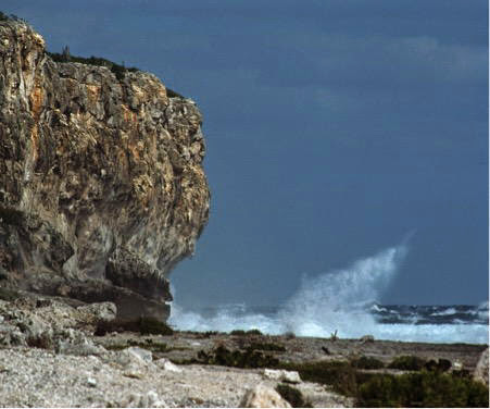
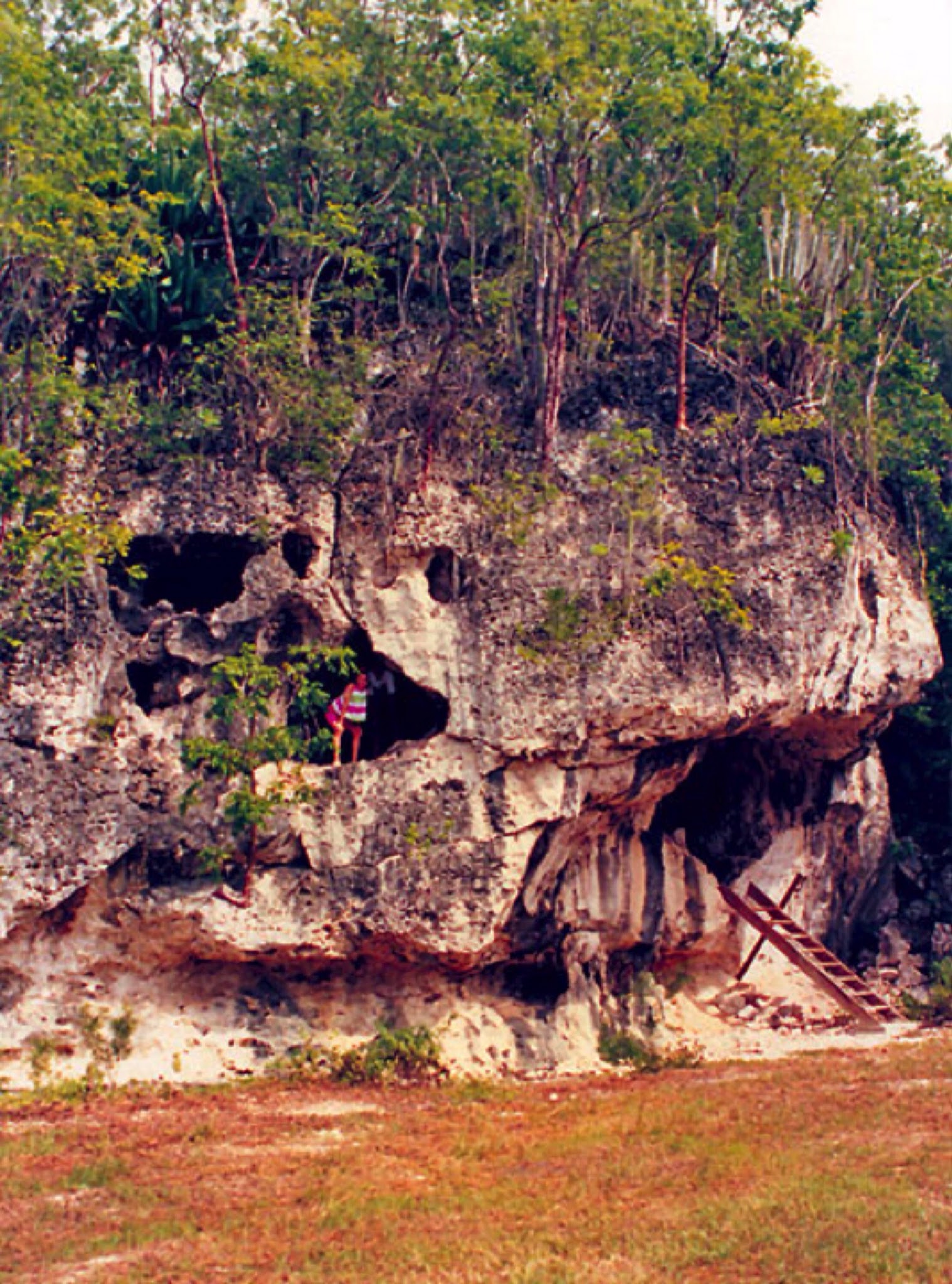
Photos above from Cayman Brac, Cayman Islands.


Tuesday, May 27, 2014

Antarctica's ice collapse threatens metres of sea level rise within decades

Scientists know that if Antarctica's ice sheets and glaciers collapse, sea levels could rise 5 metres. But the idea that it will take 200 years to happen is based on a linear model, writes Dady Cherry. In fact, the process is exponential - and could take place 'within decades'.

We conclude that this sector of West Antarctica is undergoing a marine ice sheet instability that will significantly contribute to sea level rise in decades to come.

Imagine further that a thick layer of ice covers, not only the surface of the island that lies above the sea but also an extensive portion of the perimeter that is beneath the sea.

The peaks are higher above sea level than on any continent. In winter, the sea freezes because temperatures drop to less than -80 degrees Celsius (-112 degrees Farenheight), and the island's area grows to about 10 million square miles.

In summer when some of the ice melts, the ice cover remains on average more than a mile thick, although the overall surface area of the island shrinks to about 5 million square miles. Even in summer, however, the island is still larger than Europe or Australia. It is Antarctica, and it is impossible to imagine.

When glaciers no longer rest on bedrock, they are doomed

So let us instead consider an island that is a large glacier with a thick cover of ice that extends outward, well beyond its land area. The island is shaped roughly like an infinity symbol, with the right (east) side much larger than the left (west).

The west side is really a peninsula and archipelago that share a common bedrock, but this is invisible because of the ice cover. What we can see is that even at the perimeter, where there is no land above sea level, there is ice. In some places, the ice reaches down, well beneath the water surface, all the way to the bedrock.

This situation is unstable, because in principle, the mass of ice that is beneath the sea and in continuous contact with liquid water should eventually melt. When it does, this initially leaves an overhanging shelf of ice over the water at the island's perimeter.

Being less dense than water, this shelf will want to float up and, given enough time, will eventually break away from the more interior ice that is pinned to land above sea level. Indeed, about 40% of Antarctica's perimeter consists of such ice shelves. In another 40% of the perimeter, the ice cover reaches all the way down to the bedrock.

An uncomfortable equilibrium is coming to an end

Island, ice and sea have coexisted for millennia in an uncomfortable equilibrium. In particular, the sea temperatures have not grown sufficiently warm to erode the ice edge irreversibly.

Furthermore, the mass of ice on the surface has remained relatively constant, with the seasonal flows of water out to sea in the summer being replaced by deposits of ice in winter.

The ice shelves have not thinned sufficiently to become so weak that they would snap and float away out to sea. This was all before the one-degree Celsius warming in the Earth's surface since around 1980.

Currently, the warmer seawater is eroding the island's submerged perimeter of ice. Simultaneously, the warmer air is also melting the ice cover at such an accelerated rate that it cannot be entirely replaced in the winters.

The process is irreversible

Once both kinds of erosion become irreversible, meaning that no net ice is replaced, the ice mass will shrink and become more and more bare, in a process that will accelerate out of control until the ice appears suddenly to vanish.

This is more or less the story that Eric Rignot and his colleagues reported about West Antarctica in a Geophysical Research Letters article that was accepted for publication on May 12, 2014.

They used satellite-based radar interferometry to map the edges of a series of glaciers that drain into a large bay called the Amundsen Sea Embayment, and combined their data with the results of other kinds of surveys.

Beating a rapid retreat

They discovered that between 1992 and 2011:

  • Thwaites Glacier retreated 8.7 miles (14 km) at its core and zero to six miles (1 to 9 km) at its edges,
  • Haynes Glacier retreated 6 miles (10 km) at its edges,
  • Smith / Kohler Glacier retreated about 22 miles (35 km), and its ice shelf is barely pinned to the surface.
  • Pine Island Glacier retreated 19 miles (31 km) at its center and snapped and detached from the ground.
All these retreats occurred mostly between 2005 to 2009. The authors note that they must have had a common cause and that the most reasonable explanation is the general warming of the ocean. They further explain that there is no natural land mass to prevent the movement of the massive glaciers out to sea. They conclude:

"The retreat is proceeding along fast-flowing, accelerating sectors that are thinning, become bound to reach floatation and un-ground from the bed.

"We find no major bed obstacle upstream of the 2011 grounding lines that would prevent further retreat of the grounding lines farther south.

"We conclude that this sector of West Antarctica is undergoing a marine ice sheet instability that will significantly contribute to sea level rise in decades to come."

In other words, the disappearance of West Antarctic ice is well under way, and it is irreversible.

The melting is exponential, not linear

It is notable that this research was done under difficult circumstances. For example, the authors write that, since 2001, the ERS-2 satellite has operated without its gyroscopes, and "This made it difficult to control the antenna pointing ... ".

They further observe that "In July 2011, ERS-2 terminated its mission after 16 years of services, far exceeding its planned operational lifespan."

In addition, they make a point of acknowledging "two anonymous reviewers for their comments." Possibly, the report was delayed, and some of its more frightening arguments had to be removed before publication.

In a later publication for the general public, Rignot stressed that the estimate of 200 years for the Radmunsen sea collapse, which has been repeated again and again in the press, is based on the melting continuing at its current rate.

This we know to be impossible because the melting is an exponential process that has been accelerating all the time and will continue to accelerate even more.

How long before sea rise is catastrophic?

The acceleration is driven, among other things, by an accelerated warming of the atmosphere and sea surface, continued expansion of the ozone hole, strengthening of currents that bring greater masses of warm waters from the tropics to Antarctica, weakening of the ice shelves due to accelerated melting of the surface ice, weakening of the attachment of the ice below sea level due to an accelerated erosion, and decreasing reflectivity of the Earth.

With regard to climate change, again and again, exponential processes have been treated as if they would develop linearly, despite scientists knowing quite well that they would not. Consider for example, a storm that is approaching your house from six miles away.

The storm is currently moving at five miles per hour, but it is expected to double its speed with every new mile. Do you make sure to have cover within one hour and 12 minutes, or within about 22 minutes?

Again and again, scientists have done the equivalent of feigning surprise when their timelines, based on a completely bogus linearity, have turned out to be too long. Things have gone much too far for us to continue to play such numbers' games.

West Antarctic ice sheet could raise sea levels 5m 'within decades'

Rignot blames carbon emissions, which have tripled since the Kyoto Protocol, for the current state of affairs, and he categorically says that the collapse of the ice cover from "the Amundsen sea sector of West Antarctica [is] unstoppable, with major consequences - it will mean that sea levels will rise one metre [more than 3 feet] worldwide.

"What's more, its disappearance will likely trigger the collapse of the rest of the West Antarctic ice sheet, which comes with a sea level rise of between three and five metres [10 to more than 16 feet]. Such an event will displace millions of people worldwide."

The sea-level rise of 10 to 16 feet will come in decades, rather than 200 years. It will submerge essentially every port city in the world, including Guangzhou, Mumbai, Shanghai, Ho Chi Minh City, Kolkata, Osaka-Kobe, Alexandria, New York, New Orleans, Miami, and indeed all of South Florida.

This will likely displace over 300 million people, many of them in countries that have equated development with movement of the majority of their populations to low-elevation coastal zones in port cities.

What other impacts will follow?

The displacement and homelessness from the changes in sea level might be the least of humanity's problems. More


Wednesday, May 21, 2014

A Call to Arms: An Invitation to Demand Action on Climate Change

This is an invitation, an invitation to come to New York City. An invitation to anyone who'd like to prove to themselves, and to their children, that they give a damn about the biggest crisis our civilization has ever faced.

My guess is people will come by the tens of thousands, and it will be the largest demonstration yet of human resolve in the face of climate change. Sure, some of it will be exciting – who doesn't like the chance to march and sing and carry a clever sign through the canyons of Manhattan? But this is dead-serious business, a signal moment in the gathering fight of human beings to do something about global warming before it's too late to do anything but watch. You'll tell your grandchildren, assuming we win. So circle September 20th and 21st on your calendar, and then I'll explain.

Since Ban Ki-moon runs the United Nations, he's altogether aware that we're making no progress as a planet on slowing climate change. He presided over the collapse of global-climate talks at Copenhagen in 2009, and he knows the prospects are not much better for the "next Copenhagen" in Paris in December 2015. In order to spur those talks along, he's invited the world's leaders to New York in late September for a climate summit.

But the "world's leaders" haven't been leaders on climate change – at least not leaders enough. Like many of us, they've attended to the easy stuff, but they haven't set the world on a fundamentally new course. Barack Obama is the perfect example: Sure, he's imposed new mileage standards for cars, but he's also opened vast swaths of territory to oil drilling and coal mining, which will take us past Saudi Arabia and Russia as the world's biggest petro producer.

Like other world leaders, that is, he's tried, but not nearly hard enough. Consider what he told The New Yorker in an interview earlier this year: "At the end of the day, we're part of a long-running story. We just try to get our paragraph right." And "I think we are fortunate at the moment that we do not face a crisis of the scale and scope that Lincoln or FDR faced."

We do, though; we face a crisis as great as any president has ever encountered. Here's how his paragraph looks so far: Since he took office, summer sea ice in the Arctic has mostly disappeared, and at the South Pole, scientists in May made clear that the process of massive melt is now fully under way, with 10 feet of sea-level rise in the offing. Scientists have discovered the depth of changes in ocean chemistry: that seawater is 30 percent more acidic than just four decades ago, and it's already causing trouble for creatures at the bottom of the marine food chain. America has weathered the hottest year in its history, 2012, which saw a drought so deep that the corn harvest largely failed. At the moment, one of the biggest states in Obama's union, California, is caught in a drought deeper than any time since Europeans arrived. Hell, a few blocks south of the U.N. buildings, Hurricane Sandy turned the Lower East Side of New York into a branch of the East River. And that's just the United States. The world's scientists earlier this spring issued a 32-volume report explaining exactly how much worse it's going to get, which is, to summarize, a lot worse even than they'd thought before. It's not that the scientists are alarmists – it's that the science is alarming. Here's how one Princeton scientist summarized the situation for reporters: "We're all sitting ducks."

The gap between "We're all sitting ducks" and "We do not face a crisis" is the gap between halfhearted action and the all-out effort that might make a difference. It's the gap between changing light bulbs and changing the system that's powering our destruction.

In a rational world, no one would need to march. In a rational world, policymakers would have heeded scientists when they first sounded the alarm 25 years ago. But in this world, reason, having won the argument, has so far lost the fight. The fossil-fuel industry, by virtue of being perhaps the richest enterprise in human history, has been able to delay effective action, almost to the point where it's too late.

So in this case taking to the streets is very much necessary. It's not all that's necessary – a sprawling fossil-fuel resistance works on a hundred fronts around the world, from putting up solar panels to forcing colleges to divest their oil stocks to electioneering for truly green candidates. And it's true that marching doesn't always work: At the onset of the war in Iraq, millions marched, to no immediate avail. But there are moments when it's been essential. This is how the Vietnam War was ended, and segregation too – or consider the nuclear-freeze campaign of the early 1980s, when half a million people gathered in New York's Central Park. The rally, and all the campaigning that led to it, set the mood for a planet – even, amazingly, in the Reagan era. By mid-decade, the conservative icon was proposing to Mikhail Gorbachev that they abolish nuclear weapons altogether.

The point is, sometimes you can grab the zeitgeist by the scruff of the neck and shake it a little. At the moment, the overwhelming sense around the world is nothing will happen in time. That's on the verge of becoming a self-fulfilling prophecy – indeed, as I've written in these pages, it's very clear that the fossil-fuel industry has five times as much carbon in its reserves as it would take to break the planet. On current trajectories, the industry will burn it, and governments will make only small whimpering noises about changing the speed at which it happens. A loud movement – one that gives our "leaders" permission to actually lead, and then scares them into doing so – is the only hope of upending that prophecy.

A loud movement is, of necessity, a big movement – and this fossil-fuel resistance draws from every corner of our society. It finds powerful leadership from the environmental-justice community, the poor people, often in communities of color, who have suffered most directly under the reign of fossil fuel. In this country they're survivors of Sandy and Katrina and the BP spill; they're the people whose kids troop off to kindergarten clutching asthma inhalers because they live next to oil refineries, and the people whose reservations become resource colonies. Overseas, they're the ones whose countries are simply disappearing.

Sometimes in the past, trade unionists have fought against environmentalists – but unions in health care, mass transit, higher education, domestic work and building services are all beginning to organize for September, fully aware that there are no jobs on a dead planet. Energy-sector unions see the jobs potential in massive solar installation and a "just transition" off fossil fuels. Here's a banner I know you'll see in the streets of New York: CLIMATE/JOBS. TWO CRISES, ONE SOLUTION.

There will be clergy and laypeople from synagogues and churches and mosques, now rising in record numbers to say, "If the Bible means anything, it means that we need to care for the world God gave us." And there will, of course, be scientists, saying, "What exactly don't you understand about what we've been telling you for a quarter-century?"

And students will arrive from around the country, because who knows better how to cope with long bus rides and sleeping on floors – and who knows better that their very futures are at stake? They're near the front of this battle right now, getting arrested at Harvard and at Washington University as they fight for fossil-fuel divestment, and shaking up the establishment enough that Stanford, with its $18.7 billion endowment, just agreed to get rid of its coal stocks. Don't worry about "kids today." Kids today know how to organize at least as well as kids in the Sixties.

And then there will be those of us plain old middle-class Americans who may still benefit from our lives of cheap fossil fuel, but who just can't stand to watch the world drift into chaos. We look around and see that the price of solar panels has fallen 90 percent in a few decades; we understand that it won't be easy to shift our economy off coal and gas and oil, but we know that it will be easier than coping with temperatures that no human has ever seen. We may have different proposed solutions – carbon taxes! tidal power! – but we know that none of them will happen unless we open up some space. That's our job: opening up space for change on the scale that physics requires. No more fine words, no more nifty websites. Hard deeds. Now. More


Monday, May 19, 2014

Climate Change Will Force Us to Abandon Coastal Cities

On Monday, the New York Times reported on two new climate change studies that came to the same, terrifying conclusion: “The heat-trapping gases could destabilize other parts of Antarctica as well as the Greenland ice sheet, potentially causing enough sea-level rise that many of the world’s coastal cities would eventually have to be abandoned.”

Abandoned.

While actual abandonment would not happen for many years (we’re talking centuries), the studies warned that our actions now are irrevocable and will lock in these future sea level rises. In other words, our descendants will be dealing with irreversible damage that we are committing today.

So, fast forward a few centuries from now, what will the world look like? What will the United States look like? Will people still live in Miami? Boston? New York? We don’t know what technology we will have then and we aren’t able to predict the pattern of storms. We do know that sea levels are rising and will threaten cities along the coasts of the United States.

“Barring some extraordinary advances in technology that we currently do not foresee,” Robert Hartwig, the president of the Insurance Information Institute, said, “you are left with the options of retreating from coastal areas not only in the United States, but around the world, or building fortifications against rising sea levels that would make the projects that we now see in places like the Netherlands look like child’s play.”

The Dutch government has set aside one billion euros a year through 2100 to strengthen dunes and dams throughout the country. Due to its low-lying position, the Netherlands is one of the most at-risk countries and has already crafted a long-term strategy to ensure the country’s survival. But in the United States, where one of our two main political parties remains skeptical about man-made climate change, such planning is unlikely to happen.

“If you have a plan and vision to stay there it is more likely to occur,” Robert Nicholls, a professor of coastal engineering at the University of Southampton, wrote in an email. “But USA does not have a planning culture.”

Planning will not come cheap. The mitigation techniques needed to fortify a city like Miami will cost billions of dollars, if not more. State and local governments will undoubtedly turn to the federal government for help, but that will be a political nightmare. Americans from non-coastal regions will likely object to paying for the restoration and fortification of coastal cities that are no longer naturally fit for habitation.

“Ultimately, reality will set in in the United States too, despite it being a relatively wealthy country,” Hartwig said. “Some areas will necessarily be abandoned or potentially become, in effect, islands. That’s another possibility. You say to yourself, do I abandon Miami or do I simply wall in a certain number of square miles of what is currently Miami and in effect create an island?

“Resources are always scarce and there are going to be many in the United States who think spending every available dime of every available tax dollar to save people from rising sea levels on the coast is a complete waste of money,” Hartwig added. “And they will have a point, because they’re paying tax dollars in Missouri or in North Dakota and they will not directly see a return on this investment.”

Global warming poses risks besides rising sea level. Severe storms may increase in frequency, although it’s difficult to predict how they will play out. Saltwater intrusion could imperil farm land up the Mississippi River. Droughts may become more common. Already now, scientists are wondering whether we’ve reached Peak Phosphorus—the point at which we reach the maximum global production rate of phosphorus, an essential fertilizer for crops.

Colin Green, a professor of water economics at Middlesex University, wrote in an email that he tells his students three things: “(1) they will not be able to retire until they are 75; (b) they will need to become vegetarians because we don't have enough water to support a high meat based diet; and (c) that when they go to the supermarket, they will need to take their urine with them which will be analysed and then they will be able to buy food with the same phosphorus content as the urine they bought in.”

The consequences of our inaction today will not be fixable down the road, no matter how much money the government spends. Instead, we will focus on containing the damage, whether through mitigation or abandonment. Insurance will be an important tool to allow the government to spread around some of that risk. But that assumes insurers don’t deem certain areas uninsurable—and that in turn depends on what we do today.

“I would say that if you look at the gradual sea level rise predicted over the next century, provided appropriate mitigation on the structures and in the communities in the higher cities are undertaken, then insurance is possible in these areas albeit at higher costs,” Hartwig said.

In some cases, the federal government may sell the insurance. For instance, right now, the feds offer subsidized flood insurance to homeowners in at-risk areas. When Congress passed the Biggert-Waters Act in 2012 to allow those rates to rise to their market level, they faced a swift backlash from homeowners who were going to see their insurance rates skyrocket. Led by congressmen from Gulf states, Congress gutted the bill in March. If that is any sign of what is to come, then policymakers are not prepared for the infinitely higher costs and tough choices they will face down the road. More


Friday, April 25, 2014

Doomed Pine Island Glacier Releases Guam-Sized Iceberg into Southern Ocean

Science has confirmed it. Human-caused warming is killing Antarctica’s massive Pine Island Glacier (PIG). And this week’s release of a chunk of ice larger than Guam into the southern ocean is just one of the many major losses that will occur as part of what is now an inevitable demise of one of the world’s greatest glaciers.


The iceberg calved from Antarctica's Pine Island Glacier last November, according to NASA. The crack that produced it was first spotted in 2011. Since November, B31 has drifted out of Pine Island Bay and into the Amundsen Sea off the western side of the continent. 'The iceberg is now well out of Pine Island Bay and will soon join the more general flow in the Southern Ocean, which could be east or west in this region," iceberg researcher Grant Bigg from the University of Sheffield in England said in the NASA statement. Once that happens, the researchers worry it will be difficult track the iceberg during the long weeks of darkness that comprise the Antarctic winter. And don't expect it to melt. An iceberg of that size could hang around for a year or more, Robert Marsh, a scientist at the University of Southampton in England, said last year. The largest iceberg ever recorded was called B15. With an area of 4,250 square miles -- about the size of the state of Connecticut or the island of Jamaica - it calved off Antarctica's Ross Ice Shelf in March 2000. B15 has since broken up, but parts of it still exist around the Antarctic today.

Heat-Charged Blow to The Soft Underbelly of Antarctic Ice Shelves

As human greenhouse gas emissions caused the world’s oceans to warm, upwelling currents delivered a portion of that heat to the continental shelf zone surrounding Antarctica. A fortress of ice, numerous glacial ice shelves thrust out from this frozen land and drove deep into the sea floor. Ocean-fronting glaciers featured submerged sections hundreds of feet below the sea surface.

The warming currents encountered these massive ice faces, eroding their undersides and providing pathways for ocean waters to invade many miles beneath the glaciers. These invasions subjected the vulnerable ice shelves not only to the heat forcing of an ever-warming ocean, but also to wave and tidal stresses. The reduction in grounding and the constant variable stresses set the glaciers into a rapid seaward motion.

Antarctica’s most vulnerable glaciers lie along its western out-thrust. Two, Thwaites and the Pine Island Glacier, have recently seen very rapid increases in forward speed. Of these, the Pine Island Glacier, according to a recent study, is undergoing the process of an irreversible collapse. What this means is that the glacier’s speed of forward motion is now too great to be halted. Inevitably, even if the climate were to cool, the entire giant glacier will be launched into the world’s oceans where it will entirely melt out.

Guam-Sized Chunk of Ice to be One of Many

The Pine Island Glacier is massive, covering a total area of 68,000 square miles and, in some locations, rising to over 2,000 feet in height. It represents 10% of all the ice in the West Antarctic Ice Sheet, holding enough liquid water to raise sea levels by between 1 and 2.5 feet all on its own. And the now destabilized PIG is bound to put added stresses on the adjacent Thwaites glacier together with almost the entire West Antarctic ice system. Over recent years, PIG’s forward speed has accelerated. Increasing forward velocity by 73 percent from 1974 to 2007. Surveys made since that time show an even more rapid pace. By January of this year, studies were finding that PIG had entered a sate of irreversible collapse. So it is little wonder that enormous chunks of ice are breaking off from this massive glacier and drifting on out into the Southern Ocean.

As of early this week, the immense ice island dubbed B31 measuring 12×24 miles in size (nearly 290 square miles), slid off its temporary grounding on the sea bottom and began its journey out into the Southern Ocean. There it will remain for years, plaguing the world’s shipping lanes as it slowly disintegrates into a flotilla of icebergs. It is just the most recent event in the now ongoing decline of PIG. And we can expect many, many more major ice releases as this vast Antarctic glacier continues its dive to the sea. More

Thursday, April 10, 2014

One English Town’s Innovative Response To Sea Level Rise

Vast stretches of the Somerset Levels, an expanse of coastal plains and wetlands in southwest England, have spent much of the winter underwater. At the peak of the crisis, some 11,500 hectares (28,420 acres) was submerged as violent storms brought “biblical” deluges week after week, for months on end.

Along Britain’s scenic coastline, 80 mph gales and tidal surges have left cliffs crumbling into the rough sea, beaches and sand dunes eroded, sea defenses breached, and shorelines and harbors damaged beyond recognition.

The cliffs at Birling Gap on the East Sussex coast have suffered seven years of erosion in just two months, as over nine feet of the soft chalky cliffs fell into the sea. At Formby, on the Sefton coast, the sand dunes saw two years worth of erosion in just one epically stormy December afternoon. At South Milton Sands in Devon, sand dunes have been completely destabilized and fences and boardwalks washed away. And the list of destruction goes on and on.

All along the coast of the U.K. and in other coastal communities around the world, the threat of sea level rise and more violent storms is forcing towns and governments to make difficult choices — build higher, build stronger, or retreat. In the U.S., both strategies are being explored. Famous for its levy system, New Orleansis now also incorporating open spaces designed to flood into city planning, following designs pioneered by the Dutch. For its part, much of the New Jersey coast, devastated by Superstorm Sandy, is choosing to rely almost entirely on bigger artificial sand dunes to hold the ocean back as towns attempt to rebuild right where they were before the hurricane hit.

The U.K.’s Environment Agency is experimenting with a kind of coordinated retreat for the hardest to defend coastal areas, a tactic referred to as managed coastal realignment. It’s a controversial approach for a relatively small island nation. But the recent wild winter storms are starting to change attitudes — strategic surrender suddenly seems like it may be the smart, sustainable solution.

Getting Smart, Not Giving Up

Hostile and fearful, that’s how Adrian Thomas describes the mood in the room when West Sussex residents were told that the Medmerry sea wall in the south of England would no longer be defended.

“People thought we were giving up,” said Thomas who works as a project manager for the U.K.’s Royal Society for the Protection of Birds (RSPB). “People wanted to know why we couldn’t just build a bigger sea wall or make it out of concrete. After so many years of fighting this fight, no one wanted to hear that we just weren’t going to fight anymore.”

What the community was being presented with back in 2008 were plans for thelargest ever managed realignment of the U.K. coast — effectively moving the coastline several kilometers inland. For decades, the Environment Agency, charged with managing flood defenses in the U.K., has maintained a one kilometer sea wall built out of shingle — a shingle bank — from the beach along the coast between the town of Selsey and Bracklesham on the Manhood Peninsula in southern England.

Since the 1990s, the probability of the shingle bank being breached in any given year, however, was one in one, necessitating that the Environment Agency haul a fleet of diggers out to the beach each winter and reconstruct what nature seemed so determined to destroy. The average price tag for this un-winnable war was around £200,000 ($332,000) annually. Were the bank not repaired, however, the likely inundation zone would include the only road to Selsey, 360 homes in Selsey, a water treatment plant serving 12,000 people and multiple seasonal vacation home developments with hundreds of rental cottages. The last time the wall was seriously compromised during winter storms was in 2008. The resultant flooding cost over £5 million ($8.3 million) in damages.

The controversial plan? Cut a 100 meter channel into the shingle bank and let the ocean reclaim 500 hectares of land, transforming three farms and the RSPB nature reserve into a saltwater marsh. Then behind the newly created inter-tidal zone, about two kilometers inland, build a new seven kilometer curved clay embankment — completely “realign” the coast. The price? £28 million ($46.5 million). The coastal realignment not only moves the sea wall further inland, it also creates a powerful buffer zone of marsh that can absorb storm energy. Interestingly, there is archeological evidence that the area was originally dominated by saltwater marsh hundreds of years ago.

“If you do the math, you can’t help but wonder how a scheme that cost £28 million ($46.5 million) can be justified if it only costs £0.2 million ($332,000) to maintain the sea wall each year,” said Thomas of RSPB which owned the 50 hectares of land adjacent to the old sea wall. “But of course, it’s £0.2 million ($332,000) based on current sea levels. If you factor in sea level rise due to climate change — about an extra meter in the next 100 years — and the fact that the south of England is still tipping into the sea after the last ice age, that’s just not going to be the price in the future. Never mind the financial side, it may simply not be technically feasible.”

Early Returns

The past winter was incredibly revealing. Andy Gilham, the Environment Agency’s Regional Flood Risk Manager, believes that because of the intensity and repetition of the brutal storms that pummeled much of the U.K. with hurricane force winds and relentless rain for months, the agency just would not have physically been able to maintain the shingle bank this year.

Fortunately, the Medmerry Managed Realignment Project was completed in November after two years of construction work and just weeks before the first of the winter storms rolled in around Christmas. And the general sentiment among the project leaders and business owners and residents is that the very non-intuitive plan of punching a hole in a flood wall to reduce flooding, actually worked.

“The mood music has definitely changed,” said Thomas. “From hostile and fearful to delighted and surprised.”

Allan Chamberlain, the Estate Director at Medmerry Park Holiday Village, a development consisting of 308 vacation rental homes adjacent to the realignment scheme, will readily admit that he is shocked by how well the realigned coastline protected the area from this winter’s epic flooding.

“I think initially we had the impression we were giving up and just letting it flood,” said Chamberlain. “But when you look at it now, you can see that it is progress, not defeat. Not only were we not flooded by the sea, but the project also appears to have made the surface flooding from rain less severe. The rainwater drains into the new marsh beautifully.”

“It’s the first winter in years we haven’t had to deal with surface flooding,” he added. “We were all hoping the project just wouldn’t make it any worse, but it appears to actually be making it much better.”

Chamberlain is also thrilled about the new tourist attraction created by the expanded nature reserve. He has already noticed an increase in visitors to the park even though the season has barely begun and not all the trails around the reserve are finished. Before the realignment project there were just two short stretches of public foot paths around the small, 50 hectare RSPB reserve. Now there are 10 kilometers of foot paths and seven kilometers of new bike paths in an area completely dependent on tourism for the local economy. In addition to attracting more people, the project has also actually extended the tourism season in the area. Bunn Leisure in Selsey, the largest vacation home development in the area, once only allowed to be open for eight months because of the risk of flooding, can now extend its season for an additional two months. The vacation home park employs over 300 people.

Chamberlain is applying for a similar permit extension.

‘We Are Very Aware That We Live On An Island’

Not everyone shares Chamberlain’s enthusiasm. Ben Cooper, who owns an IT consulting company and is a member of the Selsey Town Council, still has his concerns. He would have liked to see the Environment Agency consider other alternatives such as constructing rock barriers out in the ocean in front of the coast to break wave energy.

“When you live on a small island like the U.K. it’s hard to see land go,” he said. “I think we gave up too easily and before the Environment Agency tries this somewhere else, I hope they wait and see how the project stands the test of time. Once you give land back to the sea, there’s no getting it back, so if this doesn’t work, we will have given up that land for nothing.”

One of the especially contentious issues at the beginning of the Medmerry project was the fact that in order to create the realignment project, three productive farms growing oilseed rape and winter wheat would have to be sacrificed to the sea.

“In the U.K. we are very aware that we live on an island,” said Thomas. “We know we’re not self-sufficient already, so the idea of letting go of perfectly good agricultural land struck many people as wasteful and short-sighted.”

Indeed, around the U.K. this winter, the fact that developed property is given priority for flood protection over agricultural land has led many people to question the sustainability of the Environment Agency’s approach.

The area won’t lose all of its food production value, however. The newly created estuary-like environment is expected to become an important fish nursery that will boost the local commercial fishing economy in Selsey. The salt marsh vegetation will also be farmed — not the waving wheat and barley people are accustomed to, but the land can be used for low intensity cattle grazing to produce salt marsh beef a premier meat product.

The people with the biggest reservations about the Medmerry project are actually not from the area at all.

“People in Somerset who have had to endure terrible flooding this winter are quite upset about the whole thing,” said Chamberlain. “They want to know why the Environment Agency is spending £28 million on a ‘bird park’ when they could desperately have used those funds to dredge rivers and mitigate flooding in their area.”

As it turns out, the only reason the Environment Agency was able to set aside the money for the Medmerry scheme was precisely because they were creating habitat for birds. As Andy Gilham explained, under the E.U. Habitats and Birds Directive, the U.K. is required to compensate for wildlife habitat being destroyed elsewhere along the coast by creating new habitat. In the south of England especially, areas designated as Special Areas of Conservation along the Solent strait between the Isle of Wight and the mainland are being lost through a process known as “coastal squeeze.” Coastal squeeze refers to the loss of coastal habitat as land on the seaward side of rigid coastal protection structures is eroded away. The Medmerry project created nearly 200 new hectares of wetlands with similar ecological functions as the areas being lost to the west.

While the Environment Agency has done smaller coastal realignment projects in the past, Medmerry is by far the largest and the only scheme that realigns open ocean coastline, as opposed to coastline along an inland estuary. Projects similar to Medmerry are already under development. In May 2012, the Environment Agency began construction work on a coastal realignment project on the Steart Peninsula in southwest England. The project will create a new 400 hectare and provide flood protection for Steart village.

“I do feel resonance with the kind of gut human instinct that says we can win against nature,” said Thomas. “Surely we have the technology and fortitude. But there are different ways of winning. And I feel we’ve done the big win at Medmerry.” More


Tuesday, February 11, 2014

Climate change and the world’s coasts

Coastal regions may face massive increases in damages from storm surge flooding over the course of the 21st century.

According to a new study published in the Proceedings of the National Academy of Sciences, global average storm surge damages could increase from about 10-40 billion USD per year today to up to 100,000 billion USD per year by the end of century, if no adaptation action is taken. The study lead by the Berlin-based think-tank Global Climate Forum (GCF) presents, for the first time, comprehensive global simulation results on future storm surge damages to buildings and infrastructure. Drastic increases in these damages are expected, on one hand, due to rising sea-levels and, on the other hand, due to population and economic growth. Asia and Africa may be particularly hard hit because of their rapidly growing coastal mega-cities, such as Shanghai, Manila or Lagos.

“If we ignore this problem, the consequences will be dramatic,” explained Jochen Hinkel from GCF and the study’s lead author. In 2100, up to 600 million people (around 5 percent of the global population) could be affected by coastal flooding if no adaptation measures are put in place. “Countries need to take action and invest in coastal protection measures, such as building or raising dikes, amongst other options,” urged Hinkel. With such protection measures, the projected damages could be reduced to below 80 billion USD per year during the 21st century. The researchers found that investments level of 10 to 70 billion USD per year could achieve such a reduction.

Prompt action is needed most in Asia and Africa, where today large parts of the population are

already affected by storm surge flooding. Yet even Germany must invest in coastal protection. It is not only dikes that are needed however. Alternative and more flexible coastal protection measures that better fit the natural environmental should also be developed. Examples of such alternatives to dikes are the reintroduction of mangrove forests, the rehabilitation of coastal dunes or artificial oyster banks.

Meeting the challenge of adapting to rising sea-levels will not be easy. “Poor countries and heavily impacted small-island states are not able to make the necessary investments alone. They need international support,” explained Hinkel. Adding to the challenge, international finance mechanisms have thus far proved sluggish in mobilising funds for adapting to climate change, as the debate on adaptation funding at the recent climate conference in Warsaw once again confirmed.

“If we do not reduce greenhouse gases swiftly and substantially, some regions will have to seriously consider relocating significant numbers of people in the longer run,” explained Hinkel. Yet regardless of how much sea-level rise climate change brings, careful long-term regional and urban planning can ensure that development in high-risk flood zones is avoided. This long-term perspective is however a challenge to bring about, as coastal development tends to be dominated by short-term interests of, for example, real-estate and tourism companies, which prefer to build directly at the waterfront. More


Monday, November 11, 2013

Our Perpetual Ocean

This is an animation of ocean surface currents from June 2005 to December 2007 from NASA satellites. Watch how bigger currents like the Gulf Stream in the Atlantic Ocean and the Kuroshio in the Pacific carry warm waters across thousands of miles at speeds greater than four miles per hour (six kilometers per hour); how coastal currents like the Agulhas in the Southern Hemisphere move equatorial waters toward Earth's poles; and how thousands of other ocean currents are confined to particular regions and form slow-moving, circular pools called eddies. Credit: NASA/SVS
› Download video
› Download still

The swirling flows of tens of thousands of ocean currents were captured in this scientific visualization created by NASA's Goddard Space Flight Center in Greenbelt, Md.

"There is also a 20-minute long tour, which shows these global surface currents in more detail," says Horace Mitchell, the lead of the visualization studio. "We also released a three-minute version on our NASA Visualization Explorer iPad app."

Both the 20-minute and 3-minute versions are available in high definition here: http://svs.gsfc.nasa.gov/goto?3827

The visualization covers the period June 2005 to December 2007 and is based on a synthesis of a numerical model with observational data, created by a NASA project called Estimating the Circulation and Climate of the Ocean, or ECCO for short. ECCO is a joint project between the Massachusetts Institute of Technology and NASA's Jet Propulsion Laboratory in Pasadena, Calif. ECCO uses advanced mathematical tools to combine observations with the MIT numerical ocean model to obtain realistic descriptions of how ocean circulation evolves over time.

These model-data syntheses are among the largest computations of their kind ever undertaken. They are made possible by high-end computing resources provided by NASA's Ames Research Center in Moffett Field, Calif.

ECCO model-data syntheses are being used to quantify the ocean's role in the global carbon cycle, to understand the recent evolution of the polar oceans, to monitor time-evolving heat, water, and chemical exchanges within and between different components of the Earth system, and for many other science applications.

In the particular model-data synthesis used for this visualization, only the larger, ocean basin-wide scales have been adjusted to fit observations. Smaller-scale ocean currents are free to evolve on their own according to the computer model's equations. Due to the limited resolution of this particular model, only the larger eddies are represented, and tend to look more 'perfect' than they are in real life. Despite these model limitations, the visualization offers a realistic study in both the order and the chaos of the circulating waters that populate Earth's ocean.

Data used by the ECCO project include: sea surface height from NASA's Topex/Poseidon, Jason-1, and Ocean Surface Topography Mission/Jason-2 satellite altimeters; gravity from the NASA/German Aerospace Center Gravity Recovery and Climate Experiment mission; surface wind stress from NASA's QuikScat mission; sea surface temperature from the NASA/Japan Aerospace Exploration Agency Advanced Microwave Scanning Radiometer-EOS; sea ice concentration and velocity data from passive microwave radiometers; and temperature and salinity profiles from shipborne casts, moorings and the international Argo ocean observation system. More